100×worker · job analysis
Will AI Replace Surveyors, and What Should You Do About It?
Surveying is a licensed, hands-on profession built on measurement, legal boundaries, and signed-off documents. Generative AI is already showing up in parts of that work, but not in the parts that carry legal weight.
Microsoft Research analyzed 200,000 real Copilot conversations across occupations and found that generative AI is applicable to about 14.9% of the work activities that make up a surveyor's job (Microsoft Research, Working with AI, 2025). That is a modest score compared to translators (49%) but higher than nurses (12%), and it matches what you would expect: AI is good at formatting data and drafting text, not at establishing legal boundaries or operating a total station in the field.
Anthropic's Economic Index, which classifies millions of Claude conversations against O*NET task lists, shows a similar pattern in most professions: a split between automation-like use, where AI does the task, and augmentation-like use, where AI helps you do the task faster. For surveyors, the augmentation side (drafting, summarizing, checking) is where most of the near-term change happens. Adoption is broad already: 32.7% of the EU population aged 16 to 74 used generative AI in the last three months of 2025 (Eurostat). This article sorts the surveyor's task list, based on the European Commission's ESCO taxonomy, into four groups: what AI eliminates, what it automates, what you delegate to it, and what stays yours.
A surveyor measures and records boundaries, distances, and elevations of land for construction and cadastral projects.
The task split: what AI takes over and what stays yours
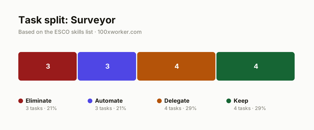
Not every surveying task changes the same way. Some tasks disappear because a tool now does them automatically. Some get handed fully to software with light checking. Some become a first draft that AI produces and you correct. And some stay entirely in your hands because they carry legal, physical, or professional weight that a model cannot take on. Sorting the job this way, rather than asking whether AI will 'take over surveying,' gives you a clearer picture of where to focus.
| Task | Bucket | Why |
|---|---|---|
| Manually retyping field notes into spreadsheets | eliminate | Direct data import from measuring instruments makes this retyping unnecessary. |
| Manually formatting standard coordinate tables from raw point clouds | eliminate | Pure copy-and-format work with no judgment call involved. |
| Rebuilding a report template from scratch every time | eliminate | A fixed template with AI-filled fields replaces this repeat work entirely. |
| Processing LiDAR or drone point clouds into a base 3D model or digital terrain model | automate | Classification and filtering steps are repetitive enough to hand to an AI agent. |
| Generating coordinate lists and measurement schedules in the required format | automate | Fixed structure, repeated data entry, no interpretation needed. |
| First conversion of field measurements into basic CAD lines and shapes | automate | Recognizing straight lines and standard shapes is pattern work, not design work. |
| Drafting the first version of a survey report | delegate | AI writes a first draft from your measurement data, you edit and sign. |
| Flagging discrepancies between new measurements and existing cadastral records | delegate | AI flags inconsistencies, you decide whether it is an error or a real change. |
| Preparing a first draft design drawing for approval | delegate | A starting point speeds up drafting, approval stays with you. |
| Summarizing technical documentation or standards for a specific project | delegate | AI searches a long standard fast and summarizes it, you check whether it applies. |
| Establishing boundaries based on legal research and fieldwork | keep | Requires local knowledge, deeds, and sometimes mediation between owners. (Your edge: Legal responsibility and local knowledge stay with the surveyor.) |
| Operating and calibrating survey equipment on site | keep | Physical work on varying terrain, with a feel for margins of error. (Your edge: Manual precision and terrain judgment cannot be automated.) |
| Approving and signing off technical designs | keep | The surveyor carries professional liability for the final result. (Your edge: Liability and the professional stamp remain legally with the human.) |
| Meeting with contractors, architects, and property owners about the site | keep | Building trust and resolving boundary disputes requires human contact. (Your edge: Trust and negotiation happen person to person.) |
Which surveyor tasks can AI take over?
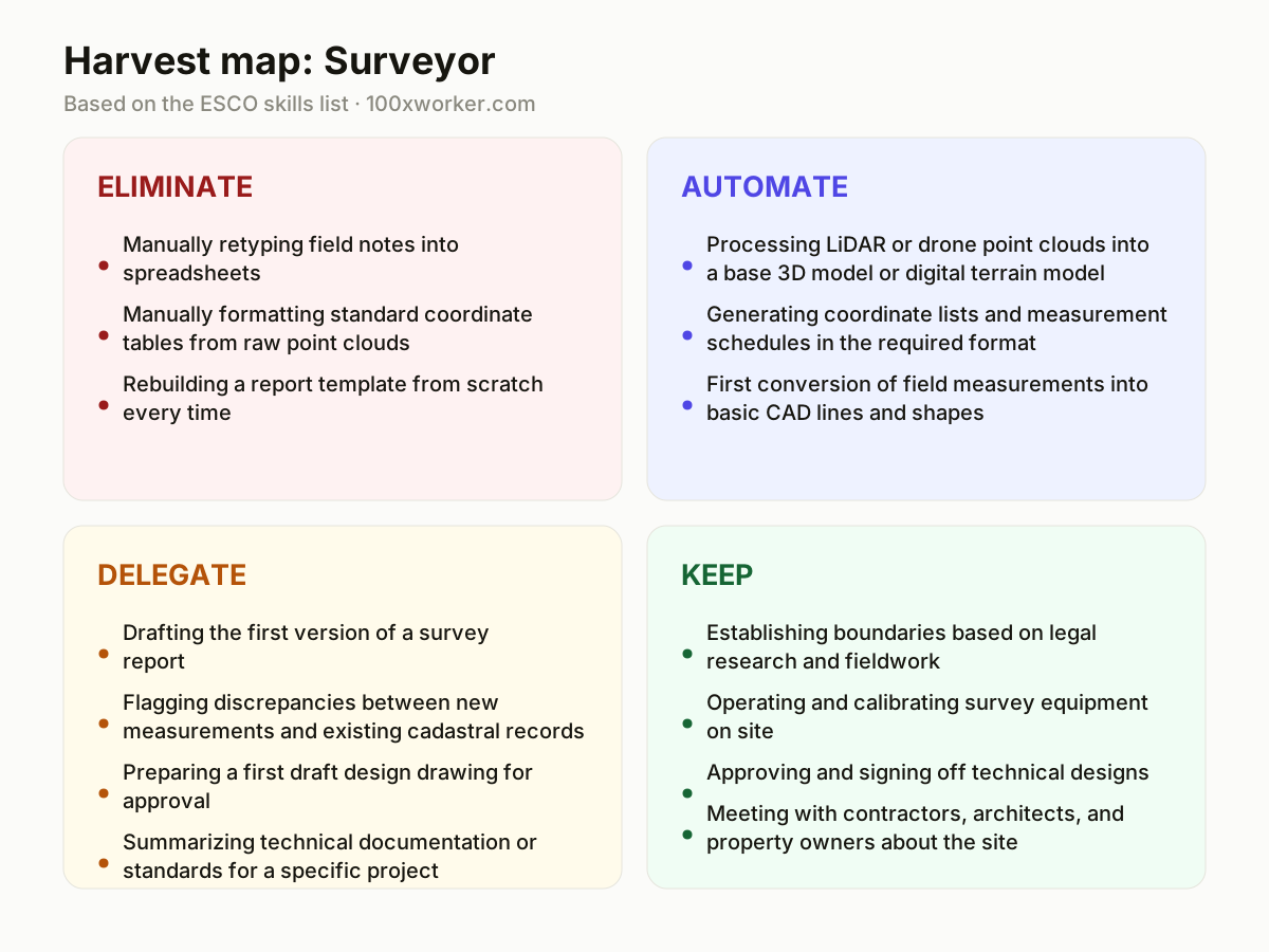
AI takes over the mechanical parts of the job first: retyping field notes, formatting coordinate tables, and rebuilding report templates. Those get eliminated outright by better data pipelines. One step up, AI can automate point cloud processing into a base 3D model or digital terrain model, generate coordinate lists in the right format, and convert raw measurements into basic CAD lines. None of this touches boundary decisions or sign-off. It removes hours of formatting and data-wrangling so more of your time goes to the fieldwork and judgment calls that actually require a licensed surveyor.
Will AI replace surveyors?
No. Microsoft Research put generative AI's applicability to surveyor work at about 14.9% of work activities, a modest share compared to occupations like translation (49%). Surveying combines legal responsibility, physical fieldwork, and a signature that carries liability, none of which a model can hold. AI changes how you spend your hours: less time on data entry and drafting, more time on boundary research, site judgment, and client conversations. The job title survives. The daily task list does not stay the same, and surveyors who adjust their workflow around AI-assisted drafting and point cloud processing will do more projects in the same time.
How does AI change a surveyor's task list?
The task list shifts toward review and decision-making. AI produces a first draft of a survey report, a first cut of a design drawing, or a flagged list of discrepancies between new measurements and cadastral records. You spend less time producing the first version and more time checking it against reality, legal documents, and site conditions. This mirrors what the ESCO taxonomy already lists as core surveyor skills: comparing survey calculations, establishing boundaries, and approving technical designs. Those judgment-heavy tasks become the center of the job, while the mechanical steps around them get compressed or removed.
What can you do this month to start using AI?
Pick one repeat task and test it: feed a general AI assistant your raw measurement data and ask for a draft survey report structured to your standard template, then compare it against what you would normally write. Try the same with a technical standard you reference often, asking for a summary of the sections relevant to a current project. Check whether your point cloud or CAD software already has AI-assisted classification or line-recognition features turned off by default. Small, task-level tests like these show you where AI actually saves time on your specific projects, rather than guessing from general claims.
Generative AI applicability measures the share of a job's work activities where AI use already shows up in real conversations, not where it theoretically could.
Microsoft Research, Working with AI (2025)
Become the AI person on your team
Draft first, edit always
Let AI produce the first version of a survey report or design drawing from your raw data. Treat it as a draft that needs your correction, not a finished document, and keep your review step non-negotiable before anything goes out with your name on it.
Automate the point cloud cleanup
If your LiDAR or drone workflow still involves manual classification of a raw point cloud, check whether your existing software already automates that filtering step. This is one of the clearest automate-bucket wins and often requires no new tool, just turning on a feature.
Use AI as a discrepancy checker, not a decision-maker
Run new measurements against existing cadastral records through an AI comparison step to flag mismatches early. You still decide whether a flagged difference is measurement error, a real boundary change, or an outdated record.
Want this for your actual task list?
The free scan on the homepage builds your personal task map in 30 seconds, based on your role and industry.
Run the free task scanTools for this work
| Tool | For which tasks | The sober take |
|---|---|---|
| Microsoft Copilot | Drafting survey reports, summarizing standards, formatting coordinate tables | General-purpose assistant, useful for drafting and summarizing, not for point cloud processing. |
| Claude (Anthropic) | Summarizing technical documentation, flagging discrepancies in written records | Strong at long-document summarizing, check outputs against the source document before relying on them. |
| AI-assisted point cloud processing modules in existing LiDAR/CAD software | Classifying and filtering point clouds into a base 3D model or DTM | Often already built into your existing survey software, worth checking before buying a new tool. |
| OCR and transcription tools | Converting handwritten or scanned field notes into digital records | Eliminates manual retyping but still needs a quick accuracy check on numbers. |
Prompts to try today
Draft a survey report from measurement data
Summarize a technical standard for a project
Flag discrepancies between new and existing records
Related jobs
Frequently asked questions
Will AI take over the surveyor profession entirely?
No. Microsoft Research's applicability score for surveyors is about 14.9%, well below occupations like translation (49%). Surveying requires physical fieldwork, legal boundary judgment, and a signature that carries professional liability, none of which AI can take on. What changes is the mix of tasks inside the job: less manual formatting and data entry, more time on review, site judgment, and client relationships.
Which part of a surveyor's job is safest from AI?
Anything involving legal boundary decisions, on-site equipment operation, and signing off on technical designs stays with the human surveyor. These tasks require local knowledge, physical precision, and professional liability that regulators and clients expect a licensed person to hold. AI can support the paperwork and drafting around these tasks, but not replace the judgment or the signature.
Do I need to learn to code to use AI in surveying?
No. Most of the useful AI applications for surveyors, drafting reports, summarizing standards, flagging discrepancies, work through plain-language prompts in tools like Copilot or Claude, or through AI features already built into point cloud and CAD software. Coding skills help if you want to automate data pipelines further, but they are not required to get started.
How widely is generative AI actually used right now?
Adoption is already substantial and growing. Eurostat reports that 32.7% of the EU population aged 16 to 74 used generative AI in the last three months of 2025. Usage skews younger and is often driven by using AI as a search tool rather than for specialized professional tasks, which is why task-specific testing matters more than general adoption figures for a licensed profession like surveying.
Sources
- Microsoft Research, Working with AI: Measuring the Applicability of Generative AI to Occupations (2025)
- Anthropic Economic Index
- Eurostat, isoc_ai_iaiu (2025)
- ESCO, European Commission
Hendrik De Winne, author of Becoming AI-Savvy, founder of VibeLab. Helps teams redesign their work with AI.
This article was drafted with AI assistance from public data sources and editorially reviewed.